Altitude Types and Sources
Altitude is important information when it comes to air traffic data. Alas, altitude data comes with different types and inaccuracies, and some altitude types can present differences of several dozens of meters.
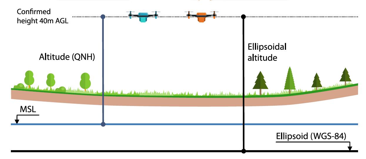
The picture below, taken from the ICARUS EU project, presents some (but not all) of the possible reference points, which can be used for measuring the altitude.
The table below presents the measurements from 2 UAVs flying at the same time and at the same altitude:

Available Altitudes Types by Data Sources:
Different data sources provide different altitude types. INVOLI processing servers currently provide two types of altitudes: amsl_altitude and barometric_altitude.
INVOLI aims to unify and standardize the different altitude types across the various data sources whenever possible but can leave minor differences unnoticed. The sections below detail the altitude types and vertical data used by each source.
ADS-B:
amsl_altitude: Obtained from aircraft transponder. The vertical datum type (i.e. ellipsoid or geoid) is dependent on the transponder, but most often it is the altitude above WGS-84 ellipsoid.
barometric_altitude: Obtained from the aircraft's barometric reading. The data is currently not adjusted for the altimeter pressure setting.
Multilateration Mode S:
amsl_altitude: The geometric altitude is obtained from the multilateration algorithm and barometric altitude data provided by the aircraft compensated for local atmospheric pressure. The resulting altitude type is WGS-84 ellipsoid.
barometric_altitude: Obtained from the aircraft's barometric reading, for which the altimeter pressure setting is unknown.
Multilateration Mode A/C:
amsl_altitude: The geometric altitude is obtained from the multilateration algorithm only, which uses the WGS-84 ellipsoid.
barometric_altitude: This type is not always available, due to the ambiguity between mode A and mode C. If available, it is the barometric reading from the aircraft, for which the altimeter pressure setting is unknown.
FLARM:
amsl_altitude: Altitude above WGS-84 ellipsoid, derived from GNSS data.
barometric_altitude: Currently not available